Pages

Tuesday, December 3, 2013

A New Black Friday Toy

Actually, I ordered this Thanksgiving morning from Amazon so it technically wasn’t Black Friday – but that was their sales gimmick so that’s what it is.

Here’s the box. With Amazon Prime tape on it no less. And I don’t have an Amazon Prime account. Or at least not that I know of. I did the free trial in 2012 when I was under a time constraint to get some stuff, but I cancelled that. Maybe I just lucked out and somebody packing made a mistake. Oh well, I’ll take it.
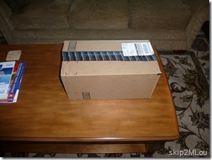
Dec 03, 2013: The box waiting to be opened
Amazon box waiting to be opened

Dec 03, 2013: The contents - ASUS T100ta and Roocase case
The contents – an ASUS T100ta and case

A couple of months back Ken had wondered if a tablet could serve as a laptop replacement on our planned overseas trips. His idea was that something smaller than our 5.5# 15” laptops would be better to schlepp around. And he’s the experienced world traveler so I had to give *some* credence to his idea.

But I had no idea if it was feasible so I started doing some research in both Apple and Android systems. I wasn’t interested in the Windows tablets because it’s all about the app ecosystem. I had already run into the fact that some apps I was interested in only existed for iOS (ipad/iphone) and not Android (my smartphone’s system). e.g. Roadside America has an app but only for iOS.

We’re certainly not power users but we have some definite requirements. We both take pictures with real cameras so need to be able to transfer those photos from the camera to the thingamabob. And I get paranoid so I also want to back up those pictures to external media. As far as photo editing, my phone has some editing capabilities so I would expect to be able to some minimal amount of that in Android. And Apple has the reputation of being the preferred platform for “real” photographers. So maybe the iOS devices also. I don’t do much photo touch-up anyway. So that’s not quite so important.

Reading email, facebook, and various news sources would be no problem because that’s what those puppies do well. Media consumption is their game.

Writing is the real kicker. I’d like to keep on top of this blog while on the road (not that I’ve been successful so far) and I’m betting that using the on screen keyboard for any extended composition would be a real pain. So that means a keyboard needs to be added. They exist, however, so that’s not an issue, it’s just  more money.

So keeping these requirements in mind, I tried to balance the advantages and disadvantages of iOS vs Android. The ipads all have a 4:3 screen ratio which I prefer for reading websites and books. I can’t see either Ken or I doing much video streaming (which does better on a 16:9 screen). But Apple has made getting content not purchased from their online store a real pain to get on or off the tablet. Which means transferring the photos from our cameras would be a pain. Photos could be transferred to the iPad with a $30 dongle add-on, but there was no way to write them out to an external hard drive or SD card. Of course we could just get bigger cards for each camera simply keep the photos on the cards rather than deleting them after transfer. That would give us two copies at least.

The other tablet I was looking at was the new Galaxy Note 10.1 2014 edition. Photo transfers wouldn’t be any problem with that one since it has a microUSB port so peripherals can easily be added and Android has a real file manger app so file transfers to and from are easy. But reading various user forums showed a lot of problems cropping up that seemed to be related to the TouchWiz software that Samsung installs on top of Android. I know I’ve had some quirks with my Samsung Galaxy S3 phone that have never been ironed out.

I went to the Apple Store and fell in love with the iPad Air. And the iPad mini. But the price and file management issues! So off to Best Buy to test drive the Galaxy Note. It also seemed very nice but wasn’t quite so intuitive. I had problems checking some blogs I would like to read, but I think it was more Best Buy’s fault than the tablet. Either their wi-fi was way overloaded or it was somehow set to not allow the tablets out of demo mode. I never could get to the outside internet to test the real thing. They were about the same price as the iPad, but certainly more expandable memory-wise.

While I had been reading up on the iPad and the Galaxy Note, I came across an announcement for the new ASUS Transformer T100 and reviews that didn’t totally pan it. It was intriguing because it is in essence a tiny laptop computer. It could also be a tablet because the screen disengages from the keyboard, but that aspect was of less interest than the fact it had full Windows capabilities (albeit Windows 8.1) and USB ports plus a microSD card reader. It weighed 2.4# and had a claimed battery life of 11 hours. All this with a list price of $399. More and more interesting. But reviews made it sound flimsy. Luckily, Best Buy had one on display and I got to play with it when I was there looking at the tablets. I thought it felt just fine and decided that’s what we would get.

Then it was a matter of watching for Black Friday sales and seeing if I could score any deals. And I did. Thursday morning when I checked Amazon, they had lowered the price to $349. Plus the case and 64GB microSD cards were on sale, too. So I ordered the ASUS, case, 2 64GB cards, and a SD card reader dongle. All that for $471 – less than either tablet I had been looking at.

Dec 03, 2013: The ASUS unboxed and charging
Unboxed and getting charged up

Dec 03, 2013: ASUS lock screen for my account
Initial setup complete

Initial impressions are pretty positive. It feels sturdy enough, maybe a little top heavy sitting on my lap. I haven’t tried it in tablet mode yet. Windows 8.1 is just as weird as I feared it would be (our laptops are running Windows 7) and it’s going to take some time figuring it out.

I still lust after an iPad, but my purchasing desires have currently been satiated. As we get closer to our Australia trip, I’ll revisit the issue. I know I’ll want two electronic devices so we can both be on the internet simultaneously. But whether it will be a second one of these or I’ll buy a tablet remains to be decided.

Saturday, October 26, 2013

Hoover Dam and Home

We didn’t even bother showering in that motel. We just dressed and headed out to find some breakfast. After that, it was just a stop at Hoover Dam to go up the pedestrian access to the new bridge and then head on home.

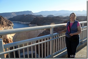
Oct 26, 2013: Mary Lou at the new Hoover Dam bridge
Ken managed to catch me with my eyes shut. Oh well.

Oct 26, 2013: Hoover Dam from the new bridge
The old road across Hoover Dam can be seen from here

This ended up being a very grueling trip for me. Per the trip odometer on the car, we covered 2668 miles in nine days. The following table has the breakdown for the six major travel days. That’s a lot of time to spend in the car.


Leg
Distance, mi Driving Time, hr Total Time, hr
Mesa to Santa Barbara 496 7.0 7.5
Santa Barbara to Fremont 338 7.5 12.0
San Francisco to Eureka 312 7.5 10.0
Eureka to Manteco 537 9.0 11.5
Manteco to Boulder City 554 9.5 12.5
Boulder City to Mesa 291 4.5 5.5

Something is going to have to be done for future trips. I don’t know what though. As I told Ken’s daughter “I would like to come home eagerly anticipating the next trip rather than dreading it.”

[written 11/14/13]

Friday, October 25, 2013

Yosemite & Mono Lake

It’s amazing what a good night’s sleep will do. After breakfast, I was even willing to get into that car again! We took CA-120 from Manteca to Yosemite’s Big Oak Flat entrance. After CA-120 split off from CA-49, the elevation started to climb and it became a lovely twisty turny mountain road with stunning views. There were also large areas where you could see the devastating effects of this summer’s fires. Many hiking trails were closed and road repair was going on in Stanislaus National Forest west of Yosemite.

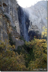
We got into the valley around 11am and stopped by Bridalveil Fall for some pictures. Easy parking and not a horde of people. I don’t know whether it’s the time of year or the recent park closure. Not much water over the fall but there is some.

Oct 25, 2013: Bridalveil Fall

Bridalveil Fall and

El Capitan
Oct 25, 2013: El Capitan

We then headed up to Yosemite Village area and managed to find some food at Degnan’s Deli. We found it surprisingly confusing to find our way around, but I suppose it was because we were in a hurry to eat and get out again.

On our way out of the valley, we hiked (really casually walked) up to the Lower Yellowstone Fall but it was dry. A short but very lovely fall day hike.

Oct 25, 2013: Lower Yosemite Fall (dry)

And the obligatory Half Dome shot even though the angle of the sun made for a washed out picture.

Oct 25, 2013: Half Dome

And that was pretty much it for Yosemite Valley. While Ken was disappointed in the poor showing of the waterfalls, that wasn’t too surprising given the time of year. I thought we lucked out in such a beautiful fall day. The foliage had turned and, even though I didn’t take any pictures of it, was glowing yellow. And it was nice to be there without the usual hordes of people. I just didn’t really get to savor it.

We left the park going east via Tioga Road. I really wanted to stop by Mono Lake to see its weird formations and didn’t really want to make a mad dash for home via the expressway.

The drive over Tioga Road through Yosemite NP and Inyo NF was another pretty mountain drive. And Mono Lake lived up to its weirdness. Those white mounds that look like dirty ice are “tufa”. The lake is highly alkaline and the towers are calcium carbonate which formed around underwater springs. When the lake level was lowered (by diverting the inflow to Los Angeles, since curtailed), the tufa towers became exposed.

2013_10_25 CA 19 Mono Lake

2013_10_25 CA 18 Mono Lake

At this point we could have headed down US-395 toward Barstow and picked up I-40. Instead we opted to head over to US-95 in Nevada and spend the night in Las Vegas. Note: neither of us like to gamble so it was for sleep only! A side benefit of this decision was that we were able to experience the "roller coaster road”. This is a portion of the section of CA-120 between US-395 and US-6 that has a lot of those whoop-de-dos we loved as kids. And it’s pretty deserted, so…

Just over the NV border, the GPS (still set on shortest route) suggested we take NV-264/NV-266 to US-95 instead of going through Tonopah. I would have overridden the GPS, but Ken decided to follow it and see. It turned out to be an interesting drive through very empty spaces. Makes you wonder why in the world they needed a good paved road through there. Google Maps shows a bunch of irrigation circles on the NV-264 section, but otherwise nothing. I suppose there is/was mining in the area.

After we hit US-95, the interesting stuff was pretty much over. We stopped in Beatty for gas and supper then headed off toward Las Vegas to look for a room for the night. Some event(s) must have been going on. Granted it was a Friday night, but still… I thought Las Vegas was supposed to have been overbuilt! We tried three different places and they were all full. We finally headed for Boulder City thinking it was smaller and less likely to have events going on. Maybe. The first casino/hotel we stopped at there was also booked. We finally did find a spot in a real sleazy motel. Well, it was a place to sleep.

[written 11/14/13]

Thursday, October 24, 2013

Mt Shasta and “One of THOSE Days”

This was a crappy day. I know some segment of “them” say you should only write about the positive (or a least the neutral), but this blog is really my diary. It’s for me to reread and remember my experiences sometime in the future. And those experiences include my emotional temperature at the time. So…

This was a crappy day. It really started last night when, after spending some time on the computer, Ken announced he thought we should skip the two-lanes and head straight down I-5 after Mt. Shasta and spend the night in Modesto. That would position us to see Yosemite on a Friday instead of on a Saturday. Friday night would be around Bakersfield and Saturday we would be home. A day earlier than planned. That rather floored me and I weakly demurred but that was about it.

Around 3:30 I woke up to go to the bathroom. I usually manage these trips in a semi-awake mode and fall back to sleep immediately. On rare occasions, however, I hit the pillow and my brain immediately starts to spin with all sorts of useless conjectures and plans and all the emotional baggage to go along with them. This was one of those times. I kept whirling between indignation, fear, and shame.

Indignation. This was my half of the trip. We visited your friends and whirled around SF at your pace. You told me to figure out what I wanted to see so I did. With no input from you. National Parks were closed when we set out so I planned things that didn’t involve them. Just because they opened up again doesn’t mean we have to change the plan. The leisurely plan. They’ll still be there for a later visit. And more of the same.

Fear. Have I made a mistake moving in with Ken? I still respect him highly, enjoy his company, and have come to love him. I also thought he would be a good travel companion. We enjoy sufficiently similar interests and types of sightseeing. But our travel styles are turning out to be drastically different. As a couple we’re supposed to adapt to each other. But I seem to be doing the adapting in spite of him declaring he needs to learn to slow down. I spent 25 years in a marriage I should have walked out of 20 years earlier. Am I making the same mistake here? Remembering the happy times and ignoring the bad? Maybe if I change this way, it will all work out?

Shame. Why didn’t I just tell him I wanted to continue with the original plan? And that I really didn’t like this motel and wanted to move to a better one. Why do I look to running away as a solution to my problem? When I was solo RVing I said I was tired of doing things by myself. Now I’m thinking I never had it so good. Is the grass always greener over there?

And so on. And being in a hotel I had no way to turn it off. When I’ve had these brain tornados in the past, I usually get up, move to the sofa, and either read or work crosswords. Sometimes I can relax enough to go back to bed; other times I’m up for the day. In either case, the spinning negativity is broken.

Not today. When we got up and dressed, I was in full martyr mode. I even had to put my wine stained socks back on because I had forgotten to transfer clean ones to the overnight bag last night.

We had breakfast then drove around the waterfront area while Ken tried to find this mansion he had remembered seeing. I found it nearby via my phone and we drove over. It was impressive, but neither of us even took pictures. Probably because it was all cloudy, but I really don’t remember. Then up the 101 to the 299 and east to I-5. That should have been a lovely twisty-turny drive with great views but the clouds hung on a while. And there was a lot of construction of the type where you wait for pilot cars. I was still pretty tired and grumpy so didn’t even enjoy the good parts. But I gradually started feeling better – probably as the sun started burning through. Or maybe it was a cup of good strong coffee we got somewhere along the way. When we hit I-5, we turned north and went up to view Mt. Shasta.

When I was researching this trip, I saw that we would be relatively close to Mt Shasta after heading east from the redwoods. I figured that, if it was a nice day, it would make a good photograph. Didn’t see much else in the area that didn’t require a large amount of physical exercise, so it was just a photo op. I had suggested to Ken that, given the number of miles he wanted to cover today, that we just skip it. But he had never photographed it before, even though he had been on that section of I-5 before, and he wanted to do it. So off we went.

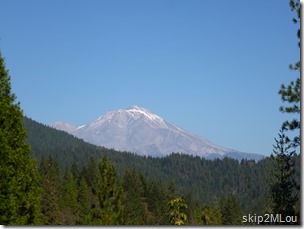
My reading had suggested that the rest area north of Weed gave a good view, so that’s what we aimed for. On our way there, we found a vista point near Castella. So we pulled over there and took some pictures. Then drove on to the rest area by Weed Airport and took some pictures there. Finally, we headed north to the next exit so we could turn around and took some more pictures there. So we got nice views of the south and west faces of Mt. Shasta.

South face of Mt. Shasta from the vista point
Oct 24, 2013: Mt Shasta from Castella vista pt (S of Weed)

Northwest face from the Airport rest area
Oct 24, 2013: Mt Shasta from Weed airport rest area

NNW view from I-5 exit 759
Oct 24, 2013: Mt Shasta I-5 exit 759

Then it was back on I-5 and just put the miles behind. It had been 226 miles and 6.5 hrs so far. And per the GPS track we put in another 312 miles and 5 hrs before we got the the hotel in Manteca. A much nicer one. I was a zombie. I had tried to doze in the car, but wasn’t really able.

[written 11/11/13. I waited several days after writing this to review it and decide what to leave in. Everything is there with just a few grammatical corrections.]

Wednesday, October 23, 2013

Goodbye San Fran, Hello Redwoods?

We got up relatively early and were on the road by 8am. The plan was to dawdle up the Pacific Coast Hwy (CA-1) until it ended at US-101. Then probably head up to Eureka for the night. That would be redwood country and I looked forward to walking amongst them, smelling them, and generally feeling their presence.

Alas, the same ol’ weather pattern was holding and it was gray and foggy on our drive out of San Francisco and up to Petaluma. There we stopped for coffee and a pee and the final decision about CA-1 vs US-101. We were optimistic and voted for CA-1 and the hopes that the marine layer would burn away as the day warmed up. Nope, it never did. You could tell this would be a very pretty drive in better weather, but it just didn’t happen for us.

We stopped in Fort Bragg for lunch at the Home Style CafĂ©. Comfy sounding name and, actually, the food lived up to it. Not really to my taste, but usually I’m looking for something I can’t easily cook myself. I had the bean soup and grilled ham & cheese special. Ken had the BBQ pork special. The real annoyance was that the waitress kept forgetting about us. I saw a couple of tables that were seated after us get their food before she even came and got our order. Looking at the GPS log, we were only there for an hour but it seemed longer.

Finally back on the CA-1 and more cloudy coastline driving until we curved around east and hit the 101 about an hour+ later. Somewhere along the way inland, the sun came out.

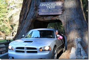
Oct 23, 2013: Mary Lou made it through without scratching the car!Ken has been in the area several times in the past umpty-ump years, most recently with Guy a couple of years ago. He thought he remembered the Drive Thru tree being somewhere around the intersection of CA-1 and US-101. Sure enough, the billboards were there as we approached. So, of course, we dropped a bit south on US-101 and drove through it. Actually, we both did. But I was the only one who stuck my head out the window so it could be proven.

Then it was on up US-101 to the Avenue of Giants through Humboldt Redwoods State Park. On the way we stopped at several old kitschy tourist traps:

The Tree House (couldn’t go inside),
Oct 23, 2013: World Famous Tree house

the Grandfather Tree,
Oct 23, 2012: The great-grandfather next to the Granfather Tree

the One Log House (didn’t go inside),
Oct 23, 2012: Presumeably it's on wheels so it's really a one-log RV!

and the Chimney Tree (went inside but nothing much to speak about).
Oct 23, 2012: Chimney Tree info

Ken seemed excited but I honestly was only minimally interested in them. I was tired – it had been a long day on the road with no real down time – and lunch’s sandwich wasn’t really sitting well.

We got to Humboldt Redwoods State Park late afternoon and drove through on the Avenue of Giants. Truly a fitting name here. But we didn’t stop and smell the roses, er, redwoods. I did make Ken slow down and took a couple of shots out the window.

Oct 23, 2012: Drive on Avenue of the Giants through Humbolt Redwoods State Park

Then we headed on to Eureka to find a hotel for the night. So much for the redwoods. I was (and still am) disappointed in the experience. I’ll have to come back some day when I can spend some more time and maybe hike in them a bit. Either here again or Redwoods National Park.

The motel we ended up at in downtown Eureka (Travelodge) was on the lower end of things in my opinion. It was also between the two separated northbound and southbound legs of US-101 so was fairly noisy. I told Ken I wasn’t interested in supper (that sandwich kept coming back) so he went out to scrounge a bottle of beer while I set up the computer and toiletry kits. I then plopped down on the bed to read & de-vibrate and found out the bedside lamps didn’t work. Neither of them. Oh well, the ereader I use doesn’t really need them, I just like a bit of light and the last person to bed will have to do it in the dark.

When Ken came back, he brought some junk food as well as a carton of wine for me. A nice thought. After I poured myself a glass, I noticed I had somehow dripped on the floor (and my foot) which I thought was strange since I could easily see what I was doing. As I screwed the cap back on, the whole cap assembly rotated and that broken seal is where it had leaked.

When I realized that, I went out to the car, dug out an empty water bottle from the back seat floor (default clean garbage area), and poured the wine in that. Dribbling all the while. Except I was clever enough to do it over the bathroom sink. I wasn’t clever enough, however, to not drink the remainder. And it was much more than I usually drink and on a nearly empty stomach to boot. (I swear that sandwich was still there!) Suffice it to say I gave Ken some comic relief as I got ready for an early bedtime.

[written 11/10/13]

Tuesday, October 22, 2013

San Francisco Day 4

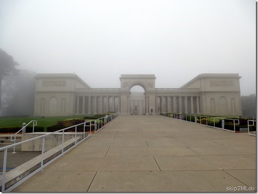
Our last day in San Francisco and we finally made it over to the Legion of Honor. I’m not really big on art museums – I overdose very fast – but I enjoy them in small doses. Ken was interested in this one because of their collection of Rodins.

The day dawned pretty much like the last with a heavy fog.

Oct 22, 2013: Legion of Honor art museum on a very foggy morning
Fog enshrouded Legion of Honor Fine Arts Museum

Oct 22, 2013: Mary Lou and "The Thinker"

Auguste Rodin’s The Thinker with another extraordinary thinker.


But Ken claims that “No, I’m the thinker!”

Oct 22, 2013: "No, I'm The Thinker"

Inside we looked at their porcelain china collection and chuckling when we saw chickens (family joke for Ken). Then on to the Rodin collection and a bunch of other things I no longer recall.

When we left the museum, it was still foggy (marine layer again) but we headed toward the coast anyway. We stopped at the overlook to the Sutro Baths but didn’t bother hiking down to them. This landmark was an entertainment complex built in 1896 and burned in 1966. It was going to be demolished anyway, so the fire just hurried it along.

Oct 22, 2013: Sutro Baths
Sutro Baths from the overlook. Still not a lot of wave action

We continued down the coast and entered Golden Gate Park near the Dutch Windmill. This windmill and another one were originally built to supply irrigation water to the park plantings. They were subsequently replaced by electric pumps and were almost destroyed by neglect. This windmill was restored in 1981 and the other in 2012. We didn’t tour either one, just stopped for a photo op.

Oct 22, 2013: Dutch windmill (1903) in Golden Gate Park
Ken’s trusty Charger in front of the Dutch Windmill
in Golden Gate Park

At this point there was some talk about lunch, but I suggested we skip it and head down to the waterfront for an early supper instead. So we headed over to St. Mary’s Cathedral. This is the third St. Mary’s Cathedral in San Francisco. The original building of the first is still standing and is now known as Old St. Mary’s. The second building was destroyed by arson in 1962. This third one was finished in 1971. It’s a very modern design and decidedly different than any I’ve seen before.

Oct 22, 2013: Cathedral of St. Mary of the Assumption (1970)
Cathedral of Saint Mary of the Assumption

Oct 22, 2013: The triumph of the risen Christ - main entrance
Main entrance

Oct 22, 2013: The central area
The nave

Oct 22, 2013:"The Baldacchino" by Richard Lippold
The Baldacchino by Richard Lippold

Oct 22, 2013: Shrine of the Pentecost
The Shrine of the Pentecost

Oct 22, 2013: Shine of the Crucifixion
The Shine of the Crucifixion

After this it was back to the hotel for a bit of downtime, then off to the waterfront again. We debated taking the cable cars to the Cable Car Museum but the lines were just as long as they were Saturday. I didn’t feel like waiting an hour to get on a car and only have about a half hour at the museum before it closed. So we walked on.

Next item to pique our interest was the San Francisco Maritime National Historic Park. The government shutdown was now over so the National Parks were open again so we walked in. Things were still chaotic since you can’t just flip a switch and everything runs immediately like it did before closing. I couldn’t figure out where the office was so I couldn’t pick up a brochure, but there were sufficient signs out on the dock to tell us what type of vessel we were looking at. For whatever reason, neither of us took any pictures so that’s that.

We continued walking up Jefferson St and, after looking a couple of menus, settled on Cioppino’s for our supper. Food was decent, prices touristy but OK, and the outside street scene fun to watch.

I deliberately chose a fairly light meal (crab cakes & salad) because I wanted to stop at Ghirardelli's for desert. We had walked past it each time we went to the Buena Vista Café, but I was too full to have any interest each time. This time, I made it the priority. I ordered the salt caramel/dark fudge sundae and Ken got the Black Forest sundae.

Oct 22, 2013: Ken dipping into *my* salt caramel/dark fudge sundae instead of his Black Forest sundae
Ken dipping into *my* sundae instead of his

Oct 22, 2013: He's really going to eat it!
I’m too busy figuring how to post a picture from my cellphone to dip into his

After that desert, we waddled on back to the hotel and called it a night. Thus endeth our time in San Francisco. My overall impression? A great place to live if you’re young but it must be very difficult for the elderly or disabled.


[written 12/21/13 – somehow I missed this day during the trip write up]

Monday, October 21, 2013

San Francisco Day 3

The day dawned cloudy but was expected to burn off away from the coast. Apparently the area is in a stable weather pattern for the next several days wherein we’re going to have beautiful weather inland and fog on the coast. So we decided to spend the morning indoors and head over the the Legion of Honor museum we missed seeing yesterday. That is until I checked the hours on the internet and found out they were closed Mondays. So, time to regroup.

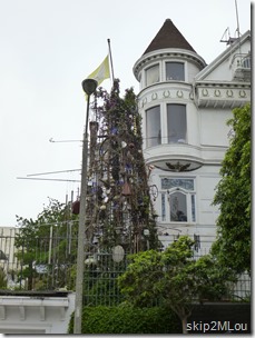
Oct 21, 2013: Ron Henggeler's 40' Teepee Tower. Art.Looking at the tourist map we had, I saw an icon for the Painted Ladies and thought it might be fun to get another iconic San Francisco photograph. So off we went to the Alamo Square area. However, once we got there and were parked, we realized we had no idea where those beauties were nor where the photographic vantage point was. So we took a couple of photographs of some Victorian houses across the street, including one which had some weird junk art assemblage in front. Notice how gray the sky still is.

We then wondered about driving around a bit to find the “real” Painted Ladies and decided, “Nah.” After all, I had seen plenty of painted up Victorians when I was living in the Boston area. They’re really pretty, but…

[BTW, that structure is “40-ft. tall junk assemblage in tiny front yard of SF artist/photographer Ron Henggeler”. I looked it up on roadsideamerica.com when we got home.]

Next we headed over to Vermont St. Per roadsideamerica.com, there is a faction claiming this is the “crookedest street in San Francisco”. I dunno. It certainly was steeper than Lombard St and the curves seemed to be tighter. But, per the Google map snippets below, there are more wiggles in Lombard St. I, personally, vote for Lombard St. But there was no traffic on Vermont St so that’s a plus in its favor.

Vermont StLombard St

It was still too cloudy to head for Coit Tower, the second original goal for today, so I pulled the Google map I had previously made and saw that Mission Dolores was close by. Off, off, and aw-a-a-y.

Brief tirade here. I like to use Google maps to plan a trip. I can create a map, plunk markers down for anything I might think interesting, and see their geographical proximity to each other. When I got my smartphone last year (Galaxy S3), I could then access that map from the Map app. It was much more convenient than the paper printout since I could zoom in & out. Then this past summer (ominous tones), Google “updated” the app and you no longer had access to those saved maps. I don’t know what they were thinking, but I don’t like the result. Searching on the internet gave the answer that I could uninstall the latest update and get the functionality back. This and a couple other changes Google has made to their offerings the last year+ have really annoyed me. I think they’re trying to link everything to Google+ for data mining reasons and I really don’t like it. OK, tirade off.

Oct 21, 2013: The original adobe mission (1791) flanked by the new basilica (1918)The first Mass at Mission San Francisco de Asis (popularly known as Mission Dolores) took place June 29, 1776 and the formal establishment of the mission occurred Oct 9, 1776. The adobe building was built completed in 1791 and is the oldest intact Mission. The basilica to the right was completed in 1918 after the previous one was destroyed in the earthquake of 1906.

The interior of the Mission has been lovingly restored and Masses are still celebrated here. The decorative alter (reredos) at the front of the Mission is from San Blas, Mexico, and was installed in 1796 and the two side alters, also from Mexico, in 1810. Amazing that everything made it through the earthquakes and subsequent fires. And the zeal for people to want to modernize things.

Oct 21, 2013: Alter & side altersOct 21, 2013: looking back toward doors

Oct 21, 2013: Cemetery - most gravestones date post gold rushThe parish cemetery is a peaceful place. This is a remnant of the original larger one and the headstones are mostly post gold-rush and predominantly feature Irish surnames. The early markers were wooden and vanished with time.

I don’t know why I enjoy Missions since I don’t have a Catholic background nor am I a religious person, but I’m drawn to them anyway. And I find the older cemeteries good for contemplation. Nothing profound ever comes of that contemplation, but does that matter?

Note from the shadows that the sun came out sometime while we were in the Mission. That means it’s time for Coit Tower.

Oct 21, 2013: Coit Tower“The tower was built in 1933 using Lillie Hitchcock Coit's
bequest to beautify the city of San Francisco [Wikipedia]”

Oct 21, 2013: View from the top of Coit Tower. Golden Gate Bridge is hiding in the marine layerThe view towards the Golden Gate Bridge. As you can see, sunshine everywhere
except for that pesky marine layer. You can just see the base of the bridge.

The other claim to fame for Coit Tower is its murals. Most of the interior is covered with these murals which were painted in 1933 under the auspices of the Publics Works of Art Project, a New Deal project. I can’t speak to their intrinsic quality, but they reminded me a lot of several Post Office murals I’ve seen.

Oct 21, 2013: Restored mural dates from 1933Oct 21, 2013: Restored mural dates from 1933

By this time we were both hungry and found a local sandwich shop, Freddie’s Sandwiches, and had some lunch. Good sandwiches with great bread but even the 6” sandwich was too much. But did I stop eating? No, of course not.  I even had a piece of baklava and a nice strong cup of coffee afterwards.

Oct 21, 2013: Grace Cathedral - built between 1928-1964The rest stop was nice, but it’s now on to more sightseeing. Next up: Grace Cathedral (Episcopalian). When the previous Grace Church was destroyed in the 1906 earthquake, this chunk of land in Nob Hill was given to the church by the Crocker family. Their house had been here but burned in the fires. Work began on the Cathedral in 1928 and was completed in 1964. Of course, there is always re-working. The interior is 60’s modern with a strong homage to the Gothic. Quite pretty in it’s own way. Fantastic stained glass windows and I love the glass? streamers in all their colors.

Oct 21, 2013: A modern take on the traditional cathedral
Looking toward the alter from the back of the Cathedral

Oct 21, 2013: Organ and choir area
The alter, choir area, and organ from the back of the pulpit

Oct 21, 2013: Destruction of old Grace Church in 1906 earthquake

There were many murals along the long side walls. This one depicts the burning of the old Grace Church in 1906.

By this time I was mentally exhausted – well overdosed on seeing new things with minimal time to digest those sights. I whined sufficiently and we went back to the hotel. Bad news was that our roomed hadn’t been cleaned and the cleaning lady was in the room next door. Good news was that the day was sunny and pleasant and there was a table outside I could sit at. So I started to read there while Ken took the car to get gas and air up one tire.

Meanwhile, the cleaning lady skipped over our room, going to the one on the other side of ours, and a panhandler sat at my table and started pestering me. So I went back to the room and waited for the maid to knock on the door. At which point I went back outside and sat & read at the now empty table.

After a nice couple of hours rest, I perked up enough to get back into the car and go over to the vista point on the Sausalito side of the Golden Gate. Alas, the marine layer had never really gone away for the day and was now pouring back in for the night. So no clear views of the Golden Gate. But I think we got some interesting photos anyway.

Oct 21, 2013: "The Lone Sailor" honoring seamen in all services. One of twelve
“The Lone Sailor” statue at the Visitor’s Center. You can see the marine layer pouring over the mountains in the background.

Oct 21, 2013: Mary Lou in front of a foggy Golden Gate Bridge
Mary Lou with what we can see of the Golden Gate in the background

After that it was back to the hotel and back to the Buena Vista. Ken ordered some supper and I longingly looked at the crab cakes our tablemates had, but I was still too full from lunch so just ordered a cup of clam chowder. And another Irish Coffee. This time I remember more of the conversation. The woman was originally from Argentina and the man is/was a local. He does art restoration and we discussed the Coit Tower murals, Diego Rivera, and post office murals to which I compared the Coit murals. That brought a laugh since he had just finished restoring the post office murals in Bodie State Historical Park. Bodie is a ghost town that’s maintained in a state of arrested decay. It’s one of the places I had put on my wish list for this trip.

Then climb back uphill to the hotel, a bit of television, and an early collapse into bed. I was tired then and no wonder! It’s taken me two days to write about it now.

[written 11/7-8/13]

Sunday, October 20, 2013

San Francisco Day 2

With the social aspects over, the rest of the trip could now be done at our own pace. Ken had reserved a hotel in San Francisco for the next three nights and I had made a list from Trip Advisor of sights I thought I might be interested in. A couple of those had been polished off yesterday, but there were still plenty left. I figured it would give us some variety in substance and location to fit our whim of the moment.

Since we couldn’t check in until mid-afternoon, we figured we would take the scenic route cutting across south of the bay and heading up the Pacific Coast. Our plan was to hit the Legion of Honor art museum (Ken’s pick) north of Golden Gate Park in the morning while it was still foggy. The San Francisco Marathon was today and it started in Golden Gate Park, but we figured it would be long gone by the time we were in the vicinity.

Well, best laid plans, et cetera, et cetera. Things went smoothly until we turned off I-280 on to CA-92 toward Half Moon Bay and joined a long line of traffic. We just figured there was an accident and we’d get by pretty soon. WRONG!! That last 7.5 miles to Half Moon Bay took 58 minutes stop and go all the way. There was a harvest festival in HMB, but surely that couldn’t be the attraction since there were harvest festivals in other towns, too. It will remain a mystery to us.

At least there was more time for the fog to burn off. WRONG!! The second disappointment occurred after we finally reached the coast. It was a dreary, foggy day and the marine layer never let up. As we approached San Francisco, we encountered our third fiasco. We could not get past Golden Gate Park to get to the art museum no matter how we twisted and turned. Roads were blocked everywhere. So we finally gave up and fought our way through the horrendous traffic to Twin Peaks.

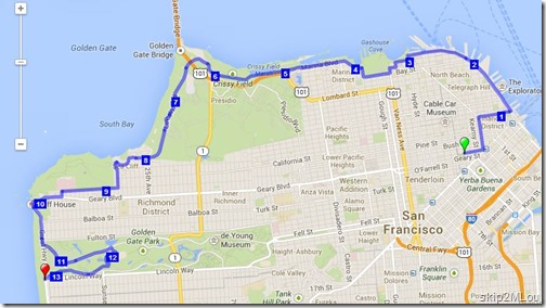
Looking at a screen capture of the race route I had made in the hotel that morning, I can see I totally misread it. The race didn’t start in Golden Gate Park, it ended there. We, of course, were getting there just about peak time. I just noticed that fact as I looked at this picture again for the blog. The Legion of Honor museum is near number 9. Mea culpa.

SF marathon

As we drove over to Twin Peaks, we got out of the fog and into sunshine. Another beautiful day away from the coast. The sun was shining on us also since we found a parking spot up top and a public restroom! The attraction of Twin Peaks is that you can see out over all of San Francisco. The panorama shows the marine layer to the left obscuring the Golden Gate Bridge. And everywhere else sunny.

Oct 20, 2013: Panorama of San Francisco from Twin Peaks. Marine layer on left is obscuring the bridge

I think the bridge is where that headland is on the left. Ken also got me to pose with downtown in the background. Proves I was there, doesn’t it? The jacket felt good, it was a little windy and chilly up there.

Oct 20, 2013: Mary Lou at Twin Peaks with San Francisco in the background

Our next stop was (were?) the nearby Moraga Steps. I had glimpsed them as we were driving to Twin Peaks so I knew they weren’t far. And they weren’t. Some interesting driving through neighborhoods, tho. STEEP streets. They should be very happy they don’t live in snow country.

The Moraga Steps (aka 16th Avenue Tiled Steps Project) consists of 163 steps from the end of Moraga St at 16th uphill to 15th Ave with beautifully tiled risers. This is a neighborhood beautification project completed in 2005. I also appreciated the garden at the base. We didn’t climb up very far so I don’t know what’s at the top.

Oct 20, 2013: Ken on the Moraga StepsOct 20, 2013: Mary Lou cheerfully posing for KenOct 20, 2013: closeup of a few of the Moraga StepsOct 20, 2013: closeup of a few of the Moraga Steps

From there, it was off to another item on my list – the Balmy Alley murals. “The murals began in the mid-80's as an expression of artists' outrage over human rights and political abuses in Central America. Today the alley contains murals on a myriad of styles and subjects from human rights to local gentrification and Hurricane Katrina.”

Here are a few:

2013_10_20 18 CA San Francisco - Balmy Alley2013_10_20 20 CA San Francisco - Balmy AlleyOct 20, 2013: Balmy Alley murals date from 1980s to presentOct 20, 2013: Balmy Alley murals date from 1980s to presentOct 20, 2013: Balmy Alley murals date from 1980s to presentOct 20, 2013: Balmy Alley murals date from 1980s to present

We could have checked into our hotel by now, but there was another item on my list relatively close by. And since it was a Sunday afternoon, we figured this would be a good time to venture into downtown San Francisco (South of Market district) with a car. So off to the Defenestration building.

Defenestration” is an art installation by Brian Goggin. It was installed in 1997 as a six month temporary exhibit in the burned out Hugo Hotel. It has lasted this long because the building owners refused to sell (or rehab) the building hoping property values would go up. This SFGate article says it’s now been taken over by eminent domain and may be demolished next year.

Oct 20, 2013: "Defenestration" by Brian Goggin, 1997. Former Hugo HotelOct 20, 2013: "Defenestration" by Brian Goggin, 1997. Former Hugo Hotel

I had OD’d on sightseeing by now so was very happy to check in to the Travelodge by the Bay and get out of the car. I lay down for a bit while Ken stretched his legs then we went next door to Bobo’s for supper. OK food but not worth the price.

Back at the motel, we relaxed a bit while I downloaded pictures from the cameras and tracks from the GPS into the computer. We then walked down to the wharf area and the Buena Vista CafĂ©. They’re claim to fame is that Irish Coffee was (presumably) invented here. So naturally we had to have some. Another twist is that you don’t have a table to yourself. You sit down at any empty spot and introduce yourselves to your new table mates. And that’s what we did. The Irish Coffees were OK, just a bit weak in the coffee department. But there was more alcohol than I would have expected from a tourist spot. And I remember having some good conversation, I just can’t remember now anything about it!

[written 11/4/13]