Pages

Friday, September 7, 2012

Home Again For the First Time

Thursday 9/6/12

A few days ago Ken had gotten a call from the friend who was checking on the house. He had found some water in the garage and determined that the water heater was leaking. Ken was able to tell him where the shut off valves, circuit breaker, and drain hose were and Lenny is a handy person so a potential disaster was averted. Since the problem was taken care of, it shouldn’t have made any difference; but, it niggled at us. That, plus I (we?) was getting tired of being on the road. Extended travel from hotel to hotel is sure different than living in an RV.
So we’re heading back home. And for me, it’s the first time. Yes, I lived in that house last spring, but it really felt more like a long visit. Now the car’s trunk is filled with things I considered my core essentials – the items I felt defined me and mine. These will now go in the house and help make it feel like I belong there.

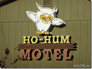
Sept 6, 2012: Not the hotel we stayed in. It was just across the street in West Yellowstone & Ken really liked the name
Sign on the hotel across the street from ours.
We both found it amusing

We got an early start and made it down to Kanab UT by early evening.

637 mi, 10:06 hrs total, 8:59 hrs moving

Friday 9/7/12

365 more miles on the road and we pulled into the driveway a little before noon. We had a quick bite to eat and Ken jumped in the pickup and headed off to Home Depot for a new water heater.  Lenny came over later and the two of them removed the old water heater and put the new one in. I’m glad we didn’t have to go without hot water for very long. In the meantime, I emptied the essentials out of the car and started setting things back up. We’re home.

365 mi, 5:37 hrs total, 5:11 hrs moving

[Written long after the fact – 12/9/13]

Wednesday, September 5, 2012

Yellowstone, Day 2

[This was the day that had me mentally stalled. Digital cameras are wonderful because they allow, nay, encourage you to take lots of photos to increase the chances of getting *just the right one*. However, that has its own price. When I finally forced myself to attack the day’s pictures, I whittled them down from well over 600 to *just* 234.]

What’s a first time visit to Yellowstone without seeing Old Faithful? Cliché, I know, but we’re tourists, after all. So I called about the expected eruption times for today – one was ~10:30am and the next was ~noon. We decided to be leisurely and aim for the noon-time eruption rather than rush for the earlier one.

So that’s what we did. On the drive down to Old Faithful, we took the Riverside Drive on the Madison river (rough and not that interesting), the Firehole Canyon Drive (nice), and stopped on Fountain Flat Drive to photograph a bison and hot spring.

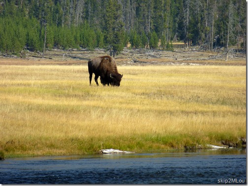
Sept 5, 2012: Bison by the Firehole River at Fountain Flat Drive pulloff
Lone bison grazing by the Firehole River.
Not too exciting after the herds at Custer State Park

Sept 5, 2012: Hot spring next to the Firehole River
Hot spring by the Firehole River.
It looks so tempting, at least near the outflow

When we got down to the Old Faithful area, it was the expected zoo with people crawling all over the place. We took our turn and had our picture taken by the sign. Then wandered over to the benches by the geyser to wait. It wasn’t too long, maybe 20 minutes or so, and we got our picture.

Sept 5, 2012: Mary Lou & Ken - Old Faithful Geyser sign

Old Faithful. We were there.

Sept 5, 2012: Old Faithful Geyser

Then back to the Lodge (which one?) for some so-so & pricey food and to plan the rest of the day. The walk around Geyser Basin was tempting to me but we decided to skip it due to time constraints. We had decided this would be our last day here and we were picking and choosing what to see. Long hikes to see a feature weren’t going to happen.

So we slowly drove back toward West Yellowstone, stopping at

Black Sand Basin: (hover mouse over to see captions)

Sept 5, 2012: The colorful banks are from the thermophiles growing in the outflow from Rainbow Pool

Sept 5, 2012: Emerald Pool

Sept 5, 2012: another happy little burbling geyser

Sept 5, 2012: looking toward Rainbow Pool

Sept 5, 2012: Sunset Lake

Sept 5, 2012: Interesting textures formed by algae, bactyerium, and other thermophiles at the Rainbow Pool outflow

Midway Geyser Basin:

Sept 5, 2012: Excelsior Geyser

Sept 5, 2012: Grand Prismatic Spring

Sept 5, 2012: Hats blown off into the Grand Prismatic Spring surround. It was a windy day

Sept 5, 2012: Opal Pool

Firehole Lake Drive:

Sept 5, 2012: Firehole Spring

Sept 5, 2012: Firehole Spring. Caught this cycle just after it started

Sept 5, 2012: Great Fountain Geyser

Sept 5, 2012: White Dome Geyser
White Dome geyser was very satisfactory.
We sat through several eruption cycles

Fountain Paint Pot:

We did coincide with a busload of people here, but managed to dawdle enough to finally shake them.

Sept 5, 2012: Geysers seen from the parking area at Fountain Paint Pot

Sept 5, 2012: Silex Spring

Sept 5, 2012: Spasm & Clepsydra Geysers

Sept 5, 2012: Clepsydra Geyser


When we hit the intersection at Madison, we decided there was enough time and energy left for one more bit of sightseeing more. So we turned right and went to Gibbon Falls. The falls themselves were nice but not that impressive. The scenic overlook area, however, was beautiful. I don’t know when it was done, but it reminded me of the CCC construction I’ve seen in other places. Lovely stonework.

Sept 5, 2012: Gibbon Falls
Gibbon Falls

Sept 5, 2012: Gibbon River above the Falls
The Gibbon River above the falls. You can see the smoke haze still in the air.

On our way out of the park, it was wildlife time. We saw a bunch of people pulled over by the Madison River so we stopped, too. That’s usually the best indicator of something to see. It turned out to be a small group of elk crossing the river. We then looked to our right and saw this big buck just sitting there.

Sept 5, 2012: Big Buck Elk seen along the Madison River
He wasn’t easy to see at first

Sept 5, 2012: Elk seen along the Madison River
Young buck and two females had just crossed the river a little upstream from the big buck

Sept 5, 2012: Lone Elk right on the roadside on our way out of the NP
Ten minutes down the road, this lone female was grazing peacefully
and didn’t care one bit about us


[written 12/9/13 – way too long afterwards]

Tuesday, September 4, 2012

Yellowstone via the Beartooth Highway

I have a cousin who lives in Bozeman MT and I debated whether or not to detour to see him (and subject Ken to yet another family visit). I finally decided it’s a shame to be so close and not stop by so I called Sunday and left a message. When we hadn’t heard back by last night, Ken went ahead and made reservations in West Yellowstone for tonight and tomorrow night – that was all we could find open by that time. It wasn’t until just before we went to bed I realized that Duh! this was Labor Day weekend and they probably were off someplace! So I quick shot him off an email telling him of our reservations. Unfortunately, I sent it from an email address that I don’t check on my phone (one of the hazards of multiple email addresses) and didn’t see his wife’s reply until too late. We were already committed to our new direction.

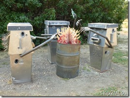
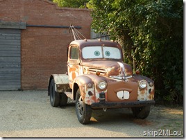
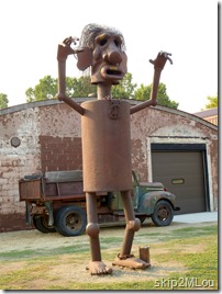
And that route took us on US-212 through Red Lodge, over the Beartooth Highway, and into the NE entrance of Yellowstone. What a wonderful drive. Serendipity occurred when we approached Joliet and saw some roadside junk art. It turns out that this was the Charles Ringer Studio & Gallery. Don’t know if there is an “inside” or not, but the stuff outside really tickled our funnybones.
Sept 4, 2012: As we were driving on US-212 toward Yellowstone, we came across these marvelous junk sculptures at the Charles Ringer Gallery 2012_09_04 002 MT Joliet Charles Ringer junk sculptures
Sept 4, 2012: Mater in all his glory (& with his hood)
The big guy was the one that caught our eye first. =>
Sept 4, 2012: Chained peacenik?

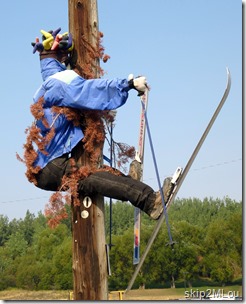
Sept 4, 2012: We burst out laughing when we saw this Then, maybe twenty miles later as we drove through Red Lodge, we saw this guy. He must have had a good downhill run! Naturally, we just *had* to stop and take his picture.
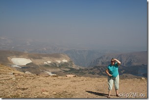
Sept 4, 2012: Mary Lou peering through the haze at a pulloff near Christmas Lake. Beartooth HwyFinally we were on the Beartooth Hwy. This was a gorgeous drive even though it could have been even more spectacular. As you can see from the picture, it was very hazy. This was mostly (all?) from various forest fires around the West. BTW, people with big rigs, I think you could make it over this road if you’re OK with the strain it would put on your engine and brakes. I don’t remember any particularly narrow areas or overhangs. And the rest areas even had parking spots painted for long vehicles. As a former 5th wheel owner, I’m still somewhat conscious of these things.

After a stop in Cooke City for an early lunch (Chili with onions, cheese, and crackers. Good, but I don’t remember the name of the place.) we made it to Yellowstone National Park. My first visit, but, naturally Ken had been there before.

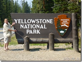
Sept 4, 2012: Ken presents the Yellowstone signKen doesn’t seem too happy here

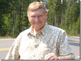
Sept 4, 2012: Finally got Ken to smile. And it's a nice one, too.
But I got him to smile on the way back to the car!


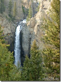
Sept 4, 2012: Tower Falls
Tower Falls

From the entrance, we wended our way to Tower-Roosevelt keeping a not-so-eagle eye out for wildlife. We didn’t see any. At Tower-Roosevelt, we turned south; our next goal was Artist Point. But first there was Tower Falls.

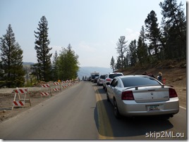
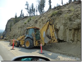
Actually, first there was a traffic jam. They were either clearing the road after a landslide or they were removing the side in preparation for some road construction. This road was scheduled to be closed Sept. 22.

Sept 4, 2012: traffic stopped north of Tower Falls
Our car in line with the rest

Sept 4, 2012: cause of jam - clearing road of debris from a landslide
Earthmoving equipment moving some earth


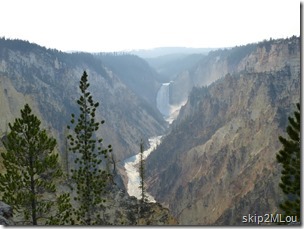
2012_09_04 033 Yellowstone NP - Artist PointWe reached Artist Point without any further incident and took our turn at the railing to get pictures of the Lower Yellowstone Falls. As you can see, it’s also very hazy here. Not the crisp clear picture Ken took in the past and has hanging in the living room. Of course, looking west in the afternoon doesn’t help. The afternoon lighting did give a nice glow, however, to the Grand Canyon of the Yellowstone when I turned around and took a panorama picture in the opposite direction.
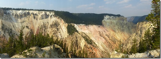
Sept 4, 2012: A panorama of the Grand Canyon of the Yellowstone from Artist Point

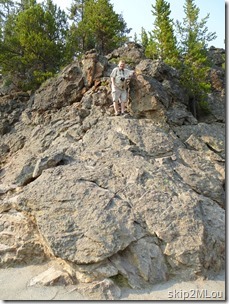
Sept 4, 2012: Ken up above. The rock wasn't that high, but awkward enough with a stiff ankle.From Artist Point, we turned around and did the rest of the South and North Rim drives. Naturally stopping at each pullout. It was still pretty crowded so we were lucky to get parking spots and needed to elbow our way through (politely!) to get to the prime spots.

At the Brink of the Upper Falls, Ken climbed up on these rocks to get a better view/picture of the Upper Yellowstone Falls. He wanted me to take a picture of him up there to commemorate the feat.
When we finished with the various Yellowstone River falls, we headed on over to Norris Basin to finish off the daylight before leaving for West Yellowstone and our hotel. This would be my first view of Yellowstone’s thermal features.
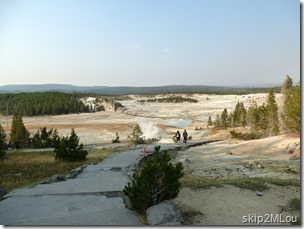
Sept 4, 2012: Starting down the path into the Basin
The path down into Norris Basin

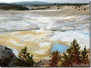
Sept 4, 2012: Porcelain Springs. Ken said it was much more active when he was here several years ago
Porcelain Springs – not very active

Actually, it was pretty disappointing. When Ken was here in the late ‘90s, he said this area was very active. He was especially looking forward to Porcelain Springs. Well, it certainly wasn’t very active when we were there. [Looking at the photographs now, I can see the great delicate beauty in the pastel colors and shadows of late afternoon. But at that time…]

After Porcelain Springs we decided to skip the rest of Porcelain Basin and look for something else before we headed to the hotel. When we got back to the museum area, we asked a ranger about the level of activity in the basin and if there was something else exciting to see here. We stressed that we weren’t going to be in Yellowstone very long and were just hitting the high points. She suggested Steamboat Geyser as a reliably erupting feature, so we hiked off to the Back Basin. And, sure enough, this was an active geyser. Not real spectacular, but bubbly enough to satisfy my desires.
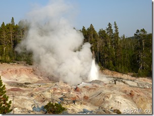
Sept 4, 2012: A nice spurt
Steamboat Geyser – at last, some action

After Norris Basin, we stopped at Artist’s Paintpots but it was really getting too close to sunset to see the colors. That was our last stop and we headed out to West Yellowstone to check into our hotel and get some supper.

Oh. We did see some wildlife. On our way out, there was a lone elk grazing by the river.
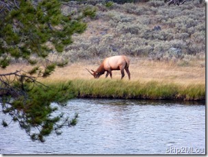
Sept 4, 2012: Elk seen on our way out to West Yellowstone


223 mi, 10:54 hrs total, 5:27 hrs moving. Highest point: 10,934 ft

[written 12/2/13 – long after the fact]
Monday, September 3, 2012

Devil’s Tower & Little Bighorn

We had a long driving day planned for today with two stops – Devil’s Tower and Little Bighorn – before we stopped in Billings MT for the night.

We got an early start on the day – breakfast at McDonald’s across the street from the motel, refueled the car, and on the road a little after 7am. First stop, Devil’s Tower, which we hit mid-morning.

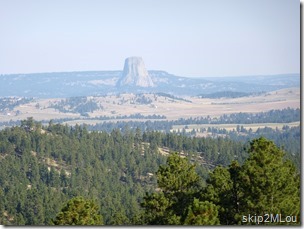
Devil’s Tower is really a remarkable geological feature, just standing out there by itself. The picture below was taken from ~10 miles away. It’s easy to see how alone this feature is. It’s even more impressive when you look at the satellite view in Google Maps.

Sept 3, 2012: An early view of Devil's Tower on the drive in
Devil’s Tower from ~10 mi away

Devil's Tower Google

We didn’t spend much time here. It was pretty much limited to using the restrooms in the Visitor’s Center and trying to take some pictures even though the sun angle made it difficult. In retrospect I wish we had walked the tower trail but we were feeling too pressured to move on.

We did stop at the prairie dog town on the way out. This little guy was looking at me right up until I got the camera out and zoomed in. I waited a while, but this was all he was showing. I guess that’s his opinion of tourists.

Sept 3, 2012: Mary Lou and Ken at the entrance to Devil's Tower (taken on the way out)
Obligatory shot of the sign – taken on the way out, of course.

Sept 3, 2012: Devil's Tower at the start of the trail (we didn't take it)
Devil’s Tower from the start of the Tower Trail. Taking pictures into the sun isn’t good.

Sept 3, 2012: Prairie dogs seen on the way out. Fast little buggers
This prairie dog just wouldn’t turn back around!

From then on, it was just boring driving. We stopped in Sheridan WY for lunch at Sanford's Grub Pub & Brewery. This was a Yelp find via my newish smartphone. I’m still pretty awkward in it’s use, but it worked well this time. Although the restaurant was crowded, we didn’t have to wait long and the food was very good.

Then back in the car and on to Montana.

We got to the Little Bighorn Battlefield National Monument around 2:30 in the afternoon. After our usual pause-that-refreshes, we did a *quick* tour of the Visitor Center museum and just made a ranger talk. The talk turned out to be excellent. The man was a natural teacher; he had his facts in hand and was able to relate them to us in a very engaging way. More importantly, he made me review my assumptions about General Custer. I had come here convinced that Custer was an utter nincompoop and used some kind of charisma and pull to get the promotions he had. That attitude is most likely an extension of my Vietnam War era youth and my opinions of our need to be there. The ranger made me reevaluate my impression of Custer and want to learn more about the man. [12/1/13 - I haven’t taken any steps in that direction yet, but I did snag a free ebook that the University of Chicago Press was offering this past January – Custerology: The Enduring Legacy of the Indian Wars and George Armstrong Custer. Haven’t read it yet, though.]

We spent nearly three hours here listening to the talk and touring the battlefield. We stopped at every marker location and read every sign. I have no interest in battlefield tactics so much of what was written was meaningless to me. But I could imagine the people on both sides and their confusion and terror. This was a battle that wasn’t supposed to happen.

Battlefields don’t really lend themselves to good pictures, but here are a few.

Sept 3, 2012: Ken gracefully presenting the entry sign
Ken presenting the entrance sign. Naturally taken as we left.

Sept 3, 2012: Last Stand Hill seen from outside the Visitor's Center
Last Stand Hill as seen from the Visitor Center

Sept 3, 2012: Memorial markers for the fallen soldiers below Last Stand Hill. #16
Markers for the fallen soldiers on the flanks of Last Stand Hill
Sept 3, 2012: Indian Memorial across the road from Last Stand Hill. We were too tired to walk over to view it
Indian Memorial near Last Stand Hill. We were too tired to walk over and view it. A decision I now regret

We got to the hotel ~6:15pm CDT, but we had changed time zones so it was ~5:15pm locally. Tell that to my body. I suppose we could have taken the extra hour to walk the Tower Trail at Devil’s Tower, but then I would have felt pressured and tired at Little Bighorn. Sigh. Can’t have everything I guess. That’s certainly one of the problems inherent in making reservations ahead of time instead of spur of the moment.

431 mi, 11:13 hrs total, 6:39 hrs moving

[written 12/1/13 – much after the fact]

Sunday, September 2, 2012

Crazy Horse & Mt Rushmore

Today was our last full day in Rapid City and we still had to see Mt. Rushmore, the Crazy Horse Memorial, and drive the Needles Highway. So that’s what we did.

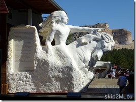
The Crazy Horse Memorial was first on the list. As usual, Ken had been here before but I hadn’t. The current visitor’s center was new him, however, and we spent a fair amount of time looking at the museum displays before we even got to the viewing veranda.

The mountain carving still has a *long* way to go. As usual, raising money is the big issue, but personal politics is also raising its ugly head. I gather there was/is a lot of controversy about putting the money into a fancy new visitor’s center instead of the mountain. I appreciated it, however. I enjoy knowing the story behind the monument; seeing the model and, more especially, the overlaid poster really helped me visualize what was going on. Maybe in another ten years we’ll go back and see how much more has been done. Certainly there’s plenty to see in the area that we didn’t get to.

Sept 2, 2012: 1/34 model of the Crazy Horse Monument with the real deal in the background
1/34th model of Crazy Horse

Sept 2, 2012: Poster with the outline overlaying a photo. Much easier to see what's what. The photo isn't current but is close
Easier to see the plan with a drawing over the photo

After Crazy Horse, we headed through Custer and turned east on 16A toward Custer State Park. It was time to drive the Needles Highway (Hwy-87). This road lived up to its reputation and is another not-to-be-missed scenic drives. Just spectacular scenery.

Sept 2, 2012: view from overlook along Needles Highway

We stopped at the Sylvan Lake General Store for a very unmemorable reheated pizza lunch. But it was that or wait in a long line for a sit-down meal. After lunch we wandered down to Sylvan Lake for a look-see. Very picturesque.

Sept 2, 2012: Sylvan Lake
Sylvan Lake

And then it was on to the Mt. Rushmore National Memorial. We walked the Presidential Trail and photographed the faces from several angles. As the clouds passed over the sun, we got various lightings, too. All fantastic to see. However, poor Teddy was always in the shadows.

Sept 2, 2012: Mary Lou and Ken at the entrance to Mount Rushmore
Yes, we were here!

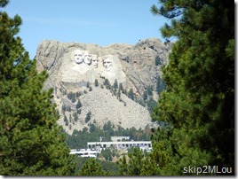
Sept 2, 2012: Mount Rushmore above the Walk of Flags
The faces above the walk of flags

2012_09_02 27 SD Mt Rushmore
Poor Teddy was always in shadow for us

Sept 2, 2012: evening lighting ceremonial
The evening ceremony

After we walked the trail and listened to a Ranger talk at Borglum’s Studio, we didn’t have much energy left to tour the Visitor Center. At least I didn’t. So back to the hotel for rest, relaxation, and supper. But we came back for the evening ceremony. Interesting to see the lighting, but I wouldn’t bother to come back to see it again unless we were staying much closer. It was very crowded and the talk wasn’t all that interesting to me.

[written 11/30/13 – long after the fact]

Saturday, September 1, 2012

Custer SP & Mammoth Hot Springs

We started the day with a leisurely breakfast and then headed down toward Custer State Park. The plan for the day was to drive the Iron Mountain Rd and the Wildlife loop. Then head on down to Hot Springs to see the Mammoth Site. Actually, I lie - the plan for the day was to drive the Iron Mountain Rd and decide what’s next after that.

The Iron Mtn Rd is a beautiful drive with pigtail bridges and three tunnels situated such that you can view Mt Rushmore from them. A very well planned road built for the simple purpose of a scenic drive. We were enjoying the drive and had gone through two of the three tunnels, stopping to take pictures of Mt Rushmore. We were at an overlook prior to the third tunnel when a group of motorcyclists pulled in. One of them told us a vehicle was stuck in the tunnel and they were going to wait around the overlook. We figured we had better head back to the picnic area and the only restrooms we had seen so far before we got in line. That detour turned out to take just the right amount of time. Most of the traffic had cleared by the time we got to the tunnel, but it had stopped again and we were third in line. The plug was a truck & trailer which had been able to back out so the traffic could clear earlier. But now he needed to turn around and that took a little time and much, probably unnecessary, help.

Sept 1, 2012: Mt Rushmore from the 3rd tunnel on the Iron Mtn Road
Mt Rushmore from near the third tunnel

2012_09_01 15 SD Custer SP Iron Mtn Rd
Waiting for the trailer to turn around

The official clearance for this tunnel is given as 13’4” wide and 12’4” high. But I’ll bet that doesn’t mean a long rectangular box of those dimensions would fit, because that trailer is certainly within those limits. Or maybe he couldn’t control it enough to center it in the tunnel. Or chickened out. I would not have even tried it with my 24’ class C.

After Iron Mtn Rd, we stopped at the Visitor Center in Custer State Park. We were trying to decide whether to take 16A through Custer and then Needles Hwy or take the Wildlife loop. The ranger said plenty of bison had been reported near the road as well as some pronghorn and mule deer. So we took the Wildlife Loop.

Near the beginning of the loop we saw a small herd of bison in the distance – my first sighting of the free roaming animal. We also saw a couple of pronghorn but not much else. However, when we got to the southern part of the loop, suddenly it’s bison all over. And, yes, I know, these bison are fed by the park and encouraged to stick around, but they are still a sight to see.

Sept 1, 2012: Despite being asked not to, people insist on feeding and petting the wild burros. SE corner of Wildlife Loop
“Hey folks, these are wild animals!” and “Didn’t you read the signs saying ‘Don’t feed the donkeys’?”

2012_09_01 32 SD Custer SP Wildlife Loop
A whole herd coming down the road toward us

2012_09_01 42 SD Custer SP Wildlife Loop
This guy came really close

2012_09_01 44 SD Custer SP Wildlife Loop
A lone bull we saw near the end of the loop. He seemed bigger than the other one.

At the end of the loop, it was decision time again. North or South? We opted to head south to Hot Springs. My sister had highly recommended going to the Mammoth Site there. That kind of thing appeals to me so off we went.

And now that I’ve been there, I have to agree with her – this site is fascinating. The actual (dried up) sinkhole is small, but the number and variety of skeletons found are amazing. I highly recommend taking the tour. It was both informative and entertaining. I could have lingered longer at the various points of interest, but it was probably long enough for most people. One tidbit we found interesting was that most of the mammoth skeletons came from “teenage” males. These are the ones who would have left their natal herd but hadn’t yet acquired the knowledge to “Stay away from that tempting vegetation over there. Something’s not right.”

Sept 1, 2012: Skeleton of a Columbian Mammoth
Columbian mammoth skeleton

Sept 1, 2012: Columbian Mammoth based on skeleton found in pit
Columbian mammoth model based on a skeleton found in the sinkhole

Sept 1, 2012: In-situ bones & tusks at the Mammoth Site
In-situ bones and tusks

Sept 1, 2012: In-situ bones & tusks at the Mammoth Site
More bones and tusks

Finally, it was time to head toward home (hotel). We headed for US-385 to take advantage of easy driving. It was late afternoon and the angled sunlight made for some striking colors as it peeked through the clouds. I was able to get this shot through the windshield. I love the play of light between the bright green grass and the clouds above. The only enhancement done on the picture was to adjust the contrast to span the full range. These really were the colors.

2012_09_01 77 SD Hwy-79 clouds

143 mi, 7:03 hrs, 3.32 hrs moving

[written 11/24/13 – much after the fact]